Contea di Park: Cosa vedere
-
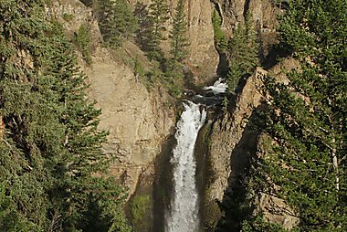
Tower Fall
Tower Fall is a waterfall on Tower Creek in the northeastern region of Yellowstone National Park, in the U.S. state of Wyoming.
-
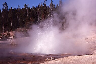
Norris Geyser Basin Museum
The Norris Geyser Basin Museum, also known as Norris Museum, is one of a series of "trailside museums" in Yellowstone National Park…
-
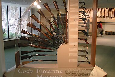
Centro dell'ovest Buffalo Bill
Il Centro dell'ovest "Buffalo Bill", precedentemente chiamato Centro storiografico Buffalo Bill, è un complesso museale composto da cinque…
-
Mount Washburn
Mount Washburn, elevation 10,219 feet, is a prominent mountain peak in the Washburn Range in Yellowstone National Park, Wyoming, United…
-
Lamar Buffalo Ranch
The Lamar Buffalo Ranch is a historic livestock ranch in the Lamar River valley of Yellowstone National Park, in the U.S. state of Wyoming.
-
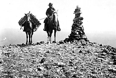
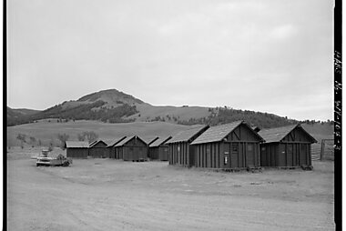
Old Trail Town
These buildings all come from the times of the 19th century American West. A charming sight that will transport you back to the past.
-
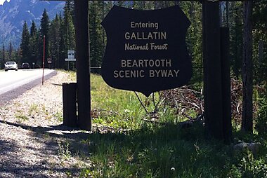
Beartooth Highway
The Beartooth Highway is an All-American Road on a section of U.S. Route 212 in Montana and Wyoming between Red Lodge and the Northeast…
-
Bunsen Peak
Bunsen Peak el. 8,564 feet is a prominent peak due south of Mammoth Hot Springs in Yellowstone National Park, Wyoming.
-
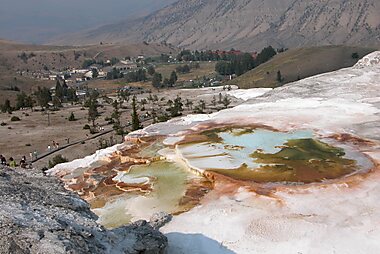
Mammoth Hot Springs
Le Mammoth Hot Springs sono un sito naturale composto da colline travertino che si sono formate a seguito dell'azione di sorgenti termali:…
-
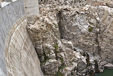
Buffalo Bill Dam
Buffalo Bill Dam is a concrete arch-gravity dam on the Shoshone River in the U.S. state of Wyoming.
-
-
-
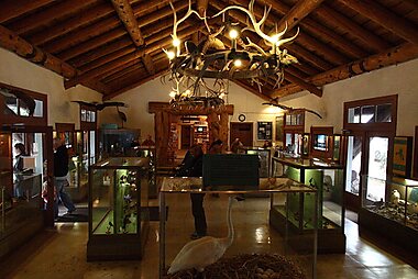
Fishing Bridge Museum
The Fishing Bridge Museum is one of a series of "trailside museums" in Yellowstone National Park, Wyoming, United States, designed by…
-
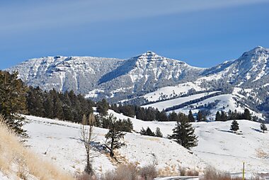
Gallatin Range
The Gallatin Range is a mountain range of the Rocky Mountains, located in the U.S. states of Montana and Wyoming.
-
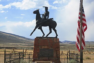
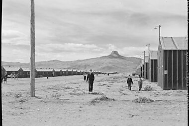
Heart Mountain Relocation Center Memorial
The Heart Mountain War Relocation Center, named after nearby Heart Mountain and located midway between the northwest Wyoming towns of Cody…
-
Beartooth Highway
The Beartooth Highway is an All-American Road on a section of U.S. Route 212 in Montana and Wyoming between Red Lodge and the Northeast…
-
Dead Indian Pass
Dead Indian Pass is a mountain pass on Wyoming Highway 296. The pass is located on Chief Joseph Scenic Byway and crosses the Absaroka Range.
-
The Thunderer
The Thunderer el. 10,558 feet is a mountain peak in the northeast section of Yellowstone National Park, in the Absaroka Range of the U.S.…
-
Eagle Peak
Eagle Peak is a mountain in the Absaroka Range in the U.S. state of Wyoming and at 11,372 feet is the highest point in Yellowstone National…
-
Younts Peak
Younts Peak is a peak in the Absaroka Range in northwestern Wyoming in the United States and the highest point in the Teton Wilderness.
-
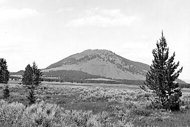
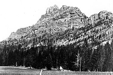
Heart Mountain
Heart Mountain is an 8,123-foot klippe just north of Cody in the U.S. state of Wyoming, rising from the floor of the Bighorn Basin.


Pianifica il tuo viaggio perfetto
Crea itinerari giorno per giorno, scopri le migliori attrazioni e naviga con facilità — su qualsiasi dispositivo.
Oppure cerca Tripomatic su App Store o Google Play.