Comté de Park: Que faire
-
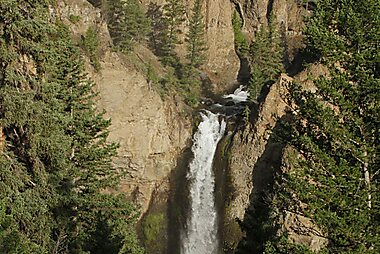
Chute Tower
La chute Tower, en anglais Tower Fall, littéralement « chute de la tour », est une chute d'eau dans le Nord-Est du parc national de…
-
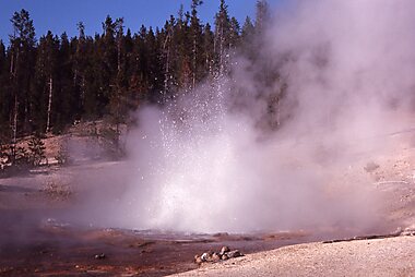
Norris Museum and Comfort Station
Les Norris Museum and Comfort Station sont deux bâtiments américains dans le comté de Park, dans le Wyoming.
-
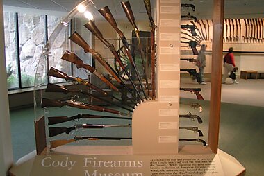
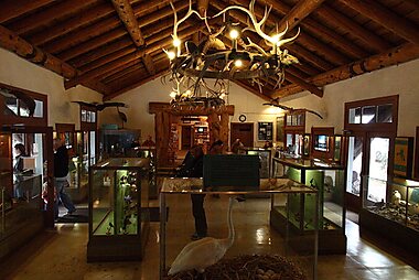
Buffalo Bill Center of the West
The Buffalo Bill Center of the West, formerly known as the Buffalo Bill Historical Center, is a complex of five museums and a research…
-
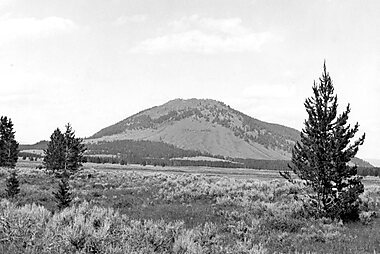
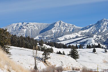
Mont Washburn
Le mont Washburn est un sommet de 3 122 m situé dans le parc national de Yellowstone dans l'État du Wyoming.
-
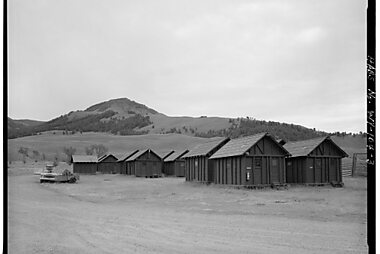
Lamar Buffalo Ranch
Le Lamar Buffalo Ranch est un ranch américain situé dans le comté de Park, dans le Wyoming.
-
Old Trail Town
These buildings all come from the times of the 19th century American West. A charming sight that will transport you back to the past.
-
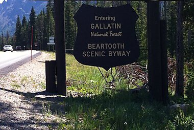
Beartooth Highway
The Beartooth Highway is an All-American Road on a section of U.S. Route 212 in Montana and Wyoming between Red Lodge and the Northeast…
-
Pic Bunsen
Le pic Bunsen est un sommet montagneux situé dans le parc national de Yellowstone, dans le comté de Park au Wyoming aux États-Unis.
-
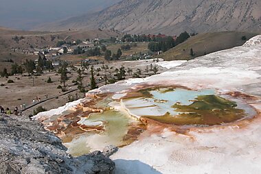
Mammoth Hot Springs
Les Mammoth Hot Springs sont un édifice minéral calcaire naturel de type tufière se trouvant dans le parc national de Yellowstone aux États…
-
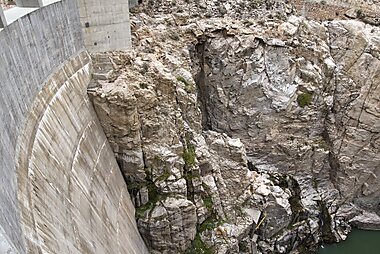
Buffalo Bill Dam
Buffalo Bill Dam is a concrete arch-gravity dam on the Shoshone River in the U.S. state of Wyoming.
-
-
-
Fishing Bridge Visitor Center and Trailside Museum
Le Fishing Bridge Visitor Center and Trailside Museum est un office de tourisme américain dans le comté de Park, dans le Wyoming.
-
Chaînon Gallatin
Le chaînon Gallatin est une chaîne de montagne qui se trouve dans l'ouest des États-Unis, dans les États du Montana et du Wyoming.
-
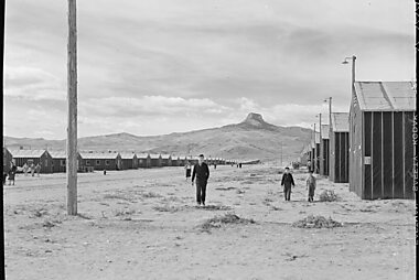
Heart Mountain Relocation Center Memorial
The Heart Mountain War Relocation Center, named after nearby Heart Mountain and located midway between the northwest Wyoming towns of Cody…
-
Beartooth Highway
The Beartooth Highway is an All-American Road on a section of U.S. Route 212 in Montana and Wyoming between Red Lodge and the Northeast…
-
Dead Indian Pass
Dead Indian Pass is a mountain pass on Wyoming Highway 296. The pass is located on Chief Joseph Scenic Byway and crosses the Absaroka Range.
-
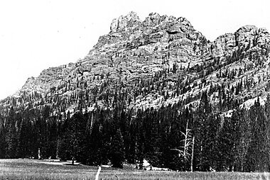
The Thunderer
The Thunderer el. 10,558 feet is a mountain peak in the northeast section of Yellowstone National Park, in the Absaroka Range of the U.S.…
-
Pic Eagle
Le pic Eagle est un sommet montagneux américain dans le comté de Park, au Wyoming.
-
Younts Peak
Younts Peak is a peak in the Absaroka Range in northwestern Wyoming in the United States and the highest point in the Teton Wilderness.
-
Heart Mountain
Heart Mountain is an 8,123-foot klippe just north of Cody in the U.S. state of Wyoming, rising from the floor of the Bighorn Basin.


Planifie ton voyage parfait
Crée des itinéraires jour par jour, découvre les meilleures attractions et navigue facilement — sur n'importe quel appareil.
Ou cherche Tripomatic sur l'App Store ou Google Play.