Condado de Park: Qué ver
-
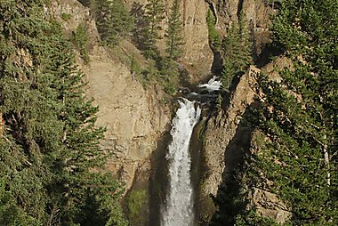
Tower Fall
Tower Fall is a waterfall on Tower Creek in the northeastern region of Yellowstone National Park, in the U.S. state of Wyoming.
-
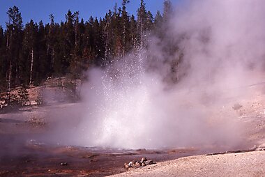
Norris Geyser Basin Museum
The Norris Geyser Basin Museum, also known as Norris Museum, is one of a series of "trailside museums" in Yellowstone National Park…
-
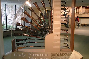
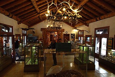
Buffalo Bill Center of the West
The Buffalo Bill Center of the West, formerly known as the Buffalo Bill Historical Center, is a complex of five museums and a research…
-
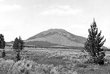
Monte Washburn
El monte Washburn es un monte de los Estados Unidos perteneciente a la cordillera Gallatin, una de las estribaciones de las Montañas…
-
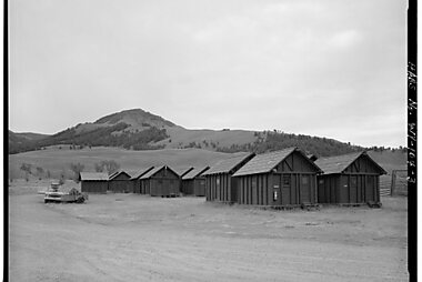
Lamar Buffalo Ranch
The Lamar Buffalo Ranch is a historic livestock ranch in the Lamar River valley of Yellowstone National Park, in the U.S. state of Wyoming.
-
Old Trail Town
These buildings all come from the times of the 19th century American West. A charming sight that will transport you back to the past.
-
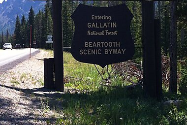
Beartooth Highway
The Beartooth Highway is an All-American Road on a section of U.S. Route 212 in Montana and Wyoming between Red Lodge and the Northeast…
-
Bunsen Peak
Bunsen Peak el. 8,564 feet is a prominent peak due south of Mammoth Hot Springs in Yellowstone National Park, Wyoming.
-
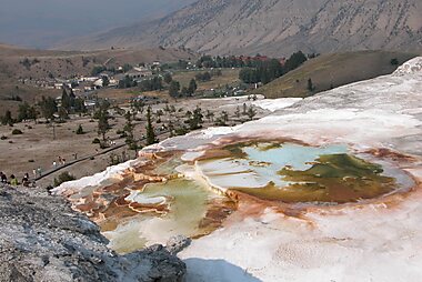
Mammoth Hot Springs Terraces
Mammoth Hot Springs is a large complex of hot springs on a hill of travertine in Yellowstone National Park adjacent to Fort Yellowstone and…
-
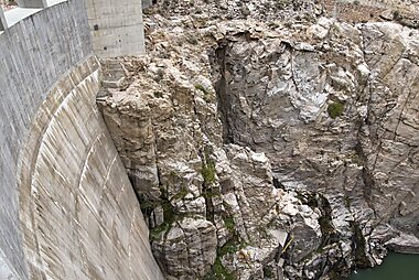
Buffalo Bill Dam
Buffalo Bill Dam is a concrete arch-gravity dam on the Shoshone River in the U.S. state of Wyoming.
-
-
-
Fishing Bridge Museum
The Fishing Bridge Museum is one of a series of "trailside museums" in Yellowstone National Park, Wyoming, United States, designed by…
-
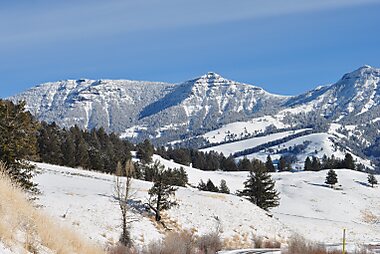
Cordillera Gallatin
La cordillera Gallatin o montes Gallatin es un sistema montañoso de los Estados Unidos, una de las estribaciones orientales de las Montañas…
-
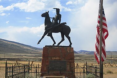
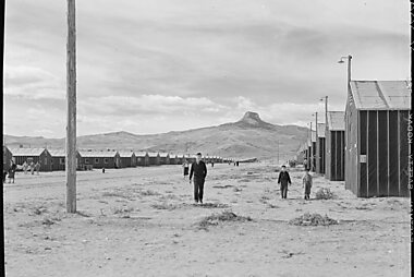
Heart Mountain Relocation Center Memorial
The Heart Mountain War Relocation Center, named after nearby Heart Mountain and located midway between the northwest Wyoming towns of Cody…
-
Beartooth Highway
The Beartooth Highway is an All-American Road on a section of U.S. Route 212 in Montana and Wyoming between Red Lodge and the Northeast…
-
Dead Indian Pass
Dead Indian Pass is a mountain pass on Wyoming Highway 296. The pass is located on Chief Joseph Scenic Byway and crosses the Absaroka Range.
-
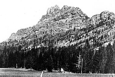
The Thunderer
The Thunderer el. 10,558 feet is a mountain peak in the northeast section of Yellowstone National Park, in the Absaroka Range of the U.S.…
-
Eagle Peak
Eagle Peak is a mountain in the Absaroka Range in the U.S. state of Wyoming and at 11,372 feet is the highest point in Yellowstone National…
-
Pico Younts
El Pico Younts es un pico ubicado en la Cordillera Absaroka en el noroeste de Wyoming en los Estados Unidos y el punto más alto en el Yermo…
-
Heart Mountain
Heart Mountain is an 8,123-foot klippe just north of Cody in the U.S. state of Wyoming, rising from the floor of the Bighorn Basin.


Planifica tu viaje perfecto
Crea itinerarios día a día, descubre las principales atracciones y navega con facilidad — en cualquier dispositivo.
O busca Tripomatic en App Store o Google Play.