Point Wilson
Point Wilson is at the end of the Quimper Peninsula, a northeast extension of the Olympic Peninsula and the northeasternmost point of… Read more…
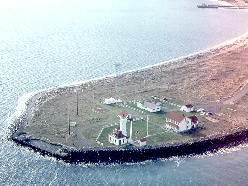

Point Wilson is at the end of the Quimper Peninsula, a northeast extension of the Olympic Peninsula and the northeasternmost point of Jefferson County, Washington, United States, approximately two miles north of the Port Townsend business district.
This low, broad sand-spit, extends over a half-mile into the water and marks the entrance to Admiralty Inlet from the Strait of Juan de Fuca. Here, the main shipping channel narrows and makes a sharp turn to the south into Puget Sound.
Nearby shoals, heavy rip-tides, and persistent fogs influenced the placing of a lighthouse on Point Wilson in 1879. In 1913, the present Point Wilson Lighthouse was built by the United States Lighthouse Service. The point is also the site of a meteorological station.
Source: Wikipedia
More information and contact

Plan Your Perfect Trip
Create day-by-day itineraries, discover top attractions, and navigate with ease — on any device.
Or search for Tripomatic in the App Store or Google Play.